KNUST Research Atlas is currently in active Beta. Report bugs or suggest features to help us improve!
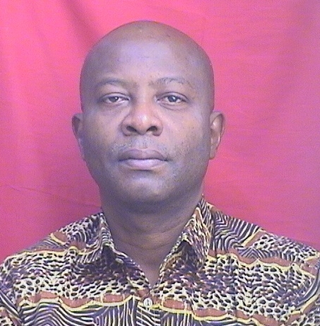
Jonathan Arthur Quaye-Ballard
The researcher has made significant contributions to understanding various aspects of environmental systems through innovative methodologies and interdisciplinary approaches, particularly focusing on hydrological processes, land use changes, soil dynamics, and resource management. Their work spans across diverse domains, including soil moisture analysis, water resources management, rainfall patterns, and agricultural practices. Through a combination of geospatial techniques, remote sensing, and applied field studies, the researcher has advanced knowledge in soil erosion, water quality monitoring, and land-use changes. Notable projects include spatial-temporal analyses of hydrological systems, geospatial modeling of forest landscapes, and digital library support for educational programs. Their research underscores the critical role of innovative technologies in addressing global challenges related to water resources, biodiversity conservation, and sustainable development in developing communities.
Faculty Biography
Professor Jonathan Arthur Quaye-Ballard is a Professor at the Department of Geomatic Engineering, Kwame Nkrumah University of Science and Technology (KNUST), Kumasi, Ghana. He is a professional member of the Ghana Institution of Surveyors (GhIS) and a Fellow of the Ghana Institution of Engineers (GhIE). He is a Licensed Surveyor. Jonathan has been in the teaching, research and consultancy services at KNUST since 2003. His research interests involve the application of Geo-Spatial Technologies in solving real-world problems concerned with transport, water, health, flood and drought, urban planning, food security, environmental resource management, etc. Areas of research include Geo-Information, Geographic Information System (GIS), Remote Sensing (RS), Geo-Visualization, Cartography, Wavelets, Computer-Supported Collaborative Learning (CSCL), and Usability Testing.Jonathan has served on many academic and institutional boards.
3D Modeling in Geospatial Applications
African Botany and Ecology Studies
Cassava research and cyanide
Climate variability and models
Coastal wetland ecosystem dynamics
Cocoa and Sweet Potato Agronomy
Conservation, Biodiversity, and Resource Management
Dam Engineering and Safety
Energy and Environment Impacts
Flood Risk Assessment and Management
Forest ecology and management
Geochemistry and Geologic Mapping
Geographic Information Systems Studies
GNSS positioning and interference
Groundwater and Watershed Analysis
Groundwater flow and contamination studies
Hydrological Forecasting Using AI
Hydrology and Drought Analysis
Hydrology and Watershed Management Studies
ICT in Developing Communities
Irrigation Practices and Water Management
Land Use and Ecosystem Services
Mining and Resource Management
Parasitic Diseases Research and Treatment
Precipitation Measurement and Analysis
Radioactive contamination and transfer
Rangeland Management and Livestock Ecology
Remote Sensing and Land Use
Remote Sensing in Agriculture
Satellite Image Processing and Photogrammetry
Soil erosion and sediment transport
Soil Moisture and Remote Sensing
Structural Health Monitoring Techniques
Urban and Rural Development Challenges
Urban Transport and Accessibility
Water Quality and Pollution Assessment
Water resources management and optimization
Web and Library Services
Department of Geomatic Engineering
Kwame Nkrumah University of Science and Technology