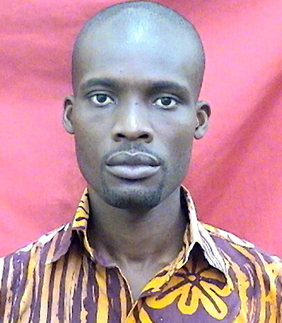
David Dotse Wemegah
The researcher's work centers on advancing hydrological studies through innovative methodologies, particularly emphasizing the integration of AI and machine learning in groundwater characterization, forecasting, and analysis. They utilize geophysical tools such as aeromagnetic and electromagnetic datasets, along with remote sensing techniques like spectral time-domain induced polarization, to assess environmental impacts in Ghana's catchments and other regions. The researcher also integrates geophysics with gravity measurements and GIS technologies for comprehensive environmental evaluations. Their focus includes education, especially geography-related studies, addressing both historical and modern contextual influences in Ghana. The research explores broader environmental dynamics, such as coastal and marine interactions, while highlighting the importance of qualitative interpretations and time-domain analyses in understanding hydrological processes.
Faculty Biography
Prof. David Dotse Wemegah is a geophysicist with a research interest in environmental and mineral exploration geophysics. He is currently an Associate Professor at the Department of Physics, KNUST. He obtained his MSc and PhD degrees in Geophysics in 2007 and 2015, respectively, from KNUST and BSc. Degree in Geology and Physics (Combined Major) from the University of Ghana, Legon. Prof. Wemegah’s research field is mainly in applying geophysics in mapping gold mineralisation zones in the greenstone belt, environmental monitoring and geotechnical investigation. He is a member of the Geophysics Research Group in the Department of Physics and an active member of the Ghana Science Association (GSA) and Society For Exploration Geophysicists (SEG).
Coastal and Marine Dynamics
Geochemistry and Geologic Mapping
Geography Education and Pedagogy
Geophysical and Geoelectrical Methods
Geophysics and Gravity Measurements
Global Maritime and Colonial Histories
Groundwater and Watershed Analysis
Groundwater flow and contamination studies
Heavy metals in environment
Hydrological Forecasting Using AI
Hydrology and Watershed Management Studies
Mercury impact and mitigation studies
Planetary Science and Exploration
Water Quality and Pollution Assessment
Groundwater potential mapping of the central region using integrated geological and geophysical methods
Open AccessMapping groundwater potential within the Owabi catchment with weighted overlay analysis to support climate smart agriculture in the Ashanti region of Ghana
Open AccessA systematic review of machine learning models for groundwater level prediction
Open AccessShoreline change detection along the eastern coast of Ghana: leveraging GIS and advanced remote sensing techniques
Open AccessIntegrating remote sensing and electrical resistivity for assessing coastal dynamics and saltwater intrusion along the eastern coast of Ghana
A systematic review of neural network applications for groundwater level prediction
Open AccessInvestigating soil and groundwater contamination around the Kpone Engineered Landfill site, Ghana, using geoelectrical methods
Groundwater potential and quality assessment of the Oti Pendjari and Obosum Groups of the Atebubu municipality
Open AccessMapping geological structures in Central Region, Ghana using airborne magnetic and radiometric datasets: Groundwater Implications
Open AccessA New Workflow for Estimating Groundwater Recharge in Data-Scarce Environments.
Application of the electrical resistivity tomography (ERT) method in identifying high groundwater potential sites in the Atebubu municipality of Ghana
Open AccessRapid groundwater assessments in gneissic settings using transient electromagnetics — Examples from Togo
Review of machine learning algorithms used in groundwater availability studies in Africa: analysis of geological and climate input variables
Open AccessIntegration of Airborne Geophysical Data, and Remote Sensing, in Groundwater Potential Mapping in the Central Region of Ghana.
Open AccessKNUST SEG Geophysics Field Camp: A project to study slavery-related archaeology in West Africa
GROUNDWATER POTENTIAL MAPPING OF THE CENTRAL REGION USING INTEGRATED GEOLOGICAL AND GEOPHYSICAL METHODS
Open AccessA Systematic Review of Neural Network Applications for Groundwater Level Prediction
Open AccessGroundwater Exploration Methods in West Africa: A Review.
Open AccessUsing Edge Detection Techniques on Aeromagnetic Data to Delineate Structures Controlling Orogenic Gold Deposits in the Sefwi Greenstone Belt, Ghana
Issue Information
Open AccessRandom forest-based mineral prospectivity modelling over the Southern Kibi–Winneba belt of Ghana using geophysical and remote sensing techniques
A Review of Geological and Climatic Variables in Groundwater Availability Prediction in Africa: Machine Learning Approaches
Open AccessA Systematic Review of Machine Learning Algorithms in Groundwater Level Simulations and Forecasting
Open AccessUncovering hidden histories through a field camp: Geophysical surveys for archaeological investigations of slavery in Ghana
Underrepresentation of Local Researchers in Geophysical Studies at the Bosumtwi Impact Crater: Insights from A Systematic Review
Open AccessDepth‐based correlation analysis between the density of lineaments in the crystalline basement's weathered zones and groundwater occurrences within the Voltaian basin, Ghana
A Systematic Review of Geophysical Studies at the Bosumtwi Impact Crater in Ghana
Open AccessEvaluating Groundwater Quality in the Asante Akyem Central District of Ghana
Open AccessHuman exposure to mercury in the atmosphere and soils in Konongo: an age-old mining centre in the Ashanti Region of Ghana
Data-Driven Multi-Index Overlay Gold Prospectivity Mapping Using Geophysical and Remote Sensing Datasets
Open AccessAnalysing multi-index overlay and fuzzy logic models for lode-gold prospectivity mapping in the Ahafo gold district – Southwestern Ghana
Open AccessGroundwater potential characterisation over the Voltaian basin using geophysical, geological, hydrological and topographical datasets
Data-driven multi-index overlay gold prospectivity mapping using geophysical and remote sensing datasets
Mapping lithological units, structural lineaments and alteration zones in the Southern Kibi-Winneba belt of Ghana using integrated geophysical and remote sensing datasets
Mesothermal gold prospectivity mapping of the southern Kibi-Winneba belt of Ghana based on Fuzzy analytical hierarchy process, concentration-area (C-A) fractal model and prediction-area (P-A) plot
The impact of climate and land-use changes on the hydrological processes of Owabi catchment from SWAT analysis
Open AccessIntegrated geophysical study of the Subika Gold Deposit in the Sefwi Belt, Ghana
Open AccessInterpretation of Geological Structures Hosting Potential Gold Deposits in the Konongo Gold Mine Using Airborne Magnetic, Electromagnetic and Radiometric Datasets
Open AccessIntegrated Geophysical and Geological Mapping of the Lithological and Geological Structures at a Proposed Generator Site
Open AccessIntegrated geophysical characterisation of Sunyani municipal solid waste disposal site using magnetic gradiometry, magnetic susceptibility survey and electrical resistivity tomography
Hydro-Climatic Modelling of an Ungauged Basin in Kumasi, Ghana
Open AccessAssessment of the quality of the Owabi reservoir and its tributaries
Open AccessHydro-Climatic Modelling of an Ungauged Basin in Kumasi, Ghana
Open AccessDistribution and ecological risks of toxic metals in the topsoils in the Kumasi metropolis, Ghana
Open AccessThe Use Of Electromagnetic And Electrical Resistivity Methods In Assessing Groundwater Resource Potentials In Adoe, Sunyani, Ghana.
Spectral time‐domain induced polarisation and magnetic surveying – an efficient tool for characterisation of solid waste deposits in developing countries
Characterization of Beauty Salon Wastewater from Kwame Nkrumah University of Science and Technology, Kumasi, Ghana, and Its Surrounding Communities
Open AccessQualitative Interpretation Of Aerogravity And Aeromagnetic Survey Data Over The South Western Part Of The Volta River Basin Of Ghana
Geophysical Interpretation of Possible Gold Mineralization Zones in Kyerano, South-Western Ghana Using Aeromagnetic and Radiometric Datasets
Open AccessTime-domain Spectral Induced Polarization and Magnetics for Mapping Municipal Solid Waste Deposits in Ghana
Chemical Analysis of Freshwater Bodies in the Kumasi Metropolis and Its Environs, Ghana
Open AccessDepartment of Physics
Kwame Nkrumah University of Science and Technology