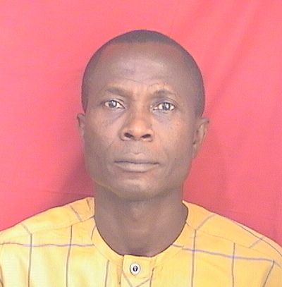
Akwasi Acheampong Aning
The researcher has demonstrated a strong focus on geophysical methods across various domains, integrating advanced techniques like electrical resistivity tomography into hydrogeology, groundwater exploration, and subsurface mapping. Their work also emphasizes the importance of interdisciplinary approaches, combining datasets such as electromagnetic and radiometric data for comprehensive mapping in hydrogeological settings. Additionally, they have contributed to advancing predictive models using compressional sonic logs and soil resistivity studies, highlighting their expertise in integrating geophysical techniques with real-world applications.
Faculty Biography
Akwasi Acheampong Aning is a geophysicist at the Department of Physics, KNUST. He holds BSc Physics and MSc Physics degrees from KNUST, PhD Geophysics form KNUST and PhD Earth Sciences from Université de Paris-Sud 11, France. His research interest is impact cratering science, groundwater and environmental geophysics.
earthquake and tectonic studies
Geochemistry and Geologic Mapping
Geography Education and Pedagogy
Geomagnetism and Paleomagnetism Studies
Geophysical and Geoelectrical Methods
Geophysical Methods and Applications
Groundwater and Watershed Analysis
Mapping groundwater potential within the Owabi catchment with weighted overlay analysis to support climate smart agriculture in the Ashanti region of Ghana
Open AccessGroundwater potential and quality assessment of the Oti Pendjari and Obosum Groups of the Atebubu municipality
Open AccessForensic Investigations of Clandestine Burials Using Ground Penetrating Radar (GPR)
Open AccessApplication of the electrical resistivity tomography (ERT) method in identifying high groundwater potential sites in the Atebubu municipality of Ghana
Open AccessKNUST SEG Geophysics Field Camp: A project to study slavery-related archaeology in West Africa
Prediction of compressional sonic log in the western (Tano) sedimentary basin of Ghana, West Africa using supervised machine learning algorithms
Open AccessElectrical Resistivity And Induced Polarization Imaging For Refuse Dump Site
Open AccessApplication of Electromagnetic and Electrical Resistivity Methods for Borehole Siting in Low-Grade Metavolcanic and Metasedimentary Rocks, Sunyani West, Ghana
Open AccessMapping the subsurface structure of the suevite deposit in the north of the Bosumtwi impact crater using electrical resistivity and seismic refraction tomographies
Open AccessIntegrated Geophysical and Geological Mapping of the Lithological and Geological Structures at a Proposed Generator Site
Open AccessInterpretation of Geological Structures Hosting Potential Gold Deposits in the Konongo Gold Mine Using Airborne Magnetic, Electromagnetic and Radiometric Datasets
Open Access2D Electrical Resistivity Imaging for Delineation of Crystalline Basement Aquifer in Northern Ghana
Open AccessProspecting for Groundwater Using the Continuous Vertical Electrical Sounding Method
Open Access2D Electrical Resistivity Tomography (ERT) Survey using the Multi-Electrode Gradient Array at the Bosumtwi Impact Crater, Ghana
Delineation of graves using electrical resistivity tomography
Groundwater Exploration using 1D and 2D Electrical Resistivity Methods
Open AccessImplications Of Soil Resistivity Measurements Using The Electrical Resistivity Method: A Case Study Of A Maize Farm Under Different Soil Preparation Modes At KNUST Agricultural Research Station, Kumasi
GEOPHYSICAL CHARACTERISTICS OF THE BOSUMTWI IMPACT CRATER FROM SEISMIC, GRAVITY AND MAGNETIC MEASUREMENTS
Open AccessThe Bosumtwi meteorite impact crater, Ghana : New Results on the impact direction of the meteorite from 2D Electrical Resistivity Tomography (ERT) Survey
Some Physical Properties of Suevites from the Bosumtwi Impact Crater, Ghana
L'impact du cratère du lac Bosumtwi : l'utilisation de la tomographie de la résistivité électrique (TRE) pour tracer la carte géométrique de la paroi internet du cr&tère et de l'impact associé à la structure
Open AccessBosumtwi impact crater : use of electrical resistivity tomography (ERT) to map the geometry of the inner wall of the crater and the impact related structures
Open AccessDepartment of Physics
Kwame Nkrumah University of Science and Technology